Welcome to a new blog that is both wonderful and strange. After spending more than six and a half years building TwinPeaksBlog.com, a website documenting my fascination with David Lynch and Mark Frost’s Twin Peaks, I’m launching a companion site that will document all of my other interests, from entertainment and pop culture to photography and travel. I’ll be taking an archivist approach to many of the stories published here, giving you interesting insights into the things I love.

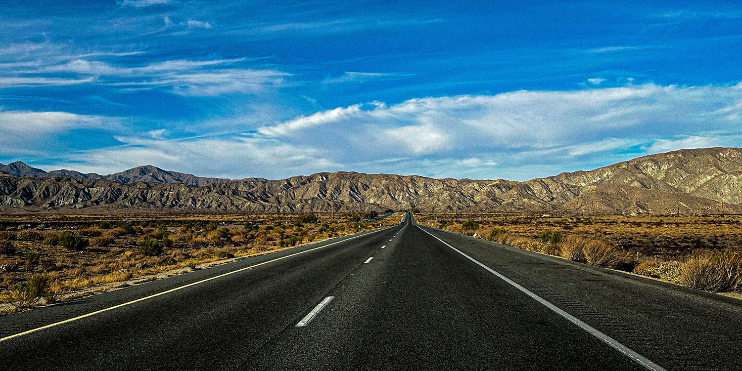
It’s fitting I begin this journey with an image I captured during a recent visit to Joshua Tree, California. The road pictured above is Twentynine Palms Highway, also known as California Route 62. This part of the 151-mile route is found just north of Interstate 10 before the road enters the mountain pass to the upper desert.

I first visited the area in May 2003 on a whim. My family stopped at Palm Springs first before taking the Twentynine Palms Highway up to Joshua Tree National Park. At the time, the only thing I knew about Joshua Tree was that the band U2 used it as the title of their 1987 album. Interestingly, the iconic album cover image was captured in Death Valley, north of Joshua Tree.

From the moment I stepped into Joshua Tree, I fell in love with the timeless space, from the oversized boulders toss across the landscape were otherworldly to the Joshua Trees with their arms stretched out toward the sky. For more than 20 years now, I’ve been returning to this area and always find something new to discover.

I’m just the latest in a long line of explorers that traveled the Twentynine Palms highway. In 1930, the Nash 400 single six sedan visited spots near “Twenty-nine Palms.” These photos by Rupent L. Larson for the Pasadena Post on April 17, 1930 capture the vehicle roaming the desert landscape. It’s wild to think those rocks probably are still found today in the upper desert.
Twentynine Palms highway was added in phases to the California state highway system. The part from White Water to Morongo Valley was added in 1935, and from Morongo Valley to Yucca Valley in 1959; both were designated as Route 187.
From Yucca Valley to Twentynine Palms, Route 218 was added in 1961. In the 1964 state highway renumbering, State Route (SR) 62 was designated from I-10 into the town of Twentynine Palms.

As a long-time photographer, I’m constantly taking photos in my mind. I turn my head – there’s a shot. Look up, another shot. Then, there are fleeting moments when I see something and have a camera nearby. This is the original image of State Route 62 I snagged on my iPhone 14 Pro while on the way to Twentynine Palms. I then edited this image in Lightroom (see the first shot in this story).
During this particular drive, the environment was showing off with its deep blue skies and wandering white clouds. I thought about the roads we take in life. Most days, I feel my destinations are unknown. I’ve found peace with this fact because I long for the journey. There is a distinct thrill in discovering what lies beyond those mountains.
With that said, I hope you’ll take the journey with me to places and stories that are both wonderful and strange.


